Owen Mickelson Web Mapping Portfolio
New Maps Plus Program At University Of Kentucky

About Me
I graduated from Morehead State University (shown in the picture with my girlfriend) in May 2016 with a Geography major and Geology minor. Currently I am working towards a Graduate Certificate in Digital Mapping through the University of Kentucky in which I will complete in April 2017. I hope to find a job in computer mapping using Geographic Information Systems (GIS). I love studying the geography of various places through maps, traveling, and outdoor exploration.
Design for Interactive Web Mapping (Map 673) Projects:
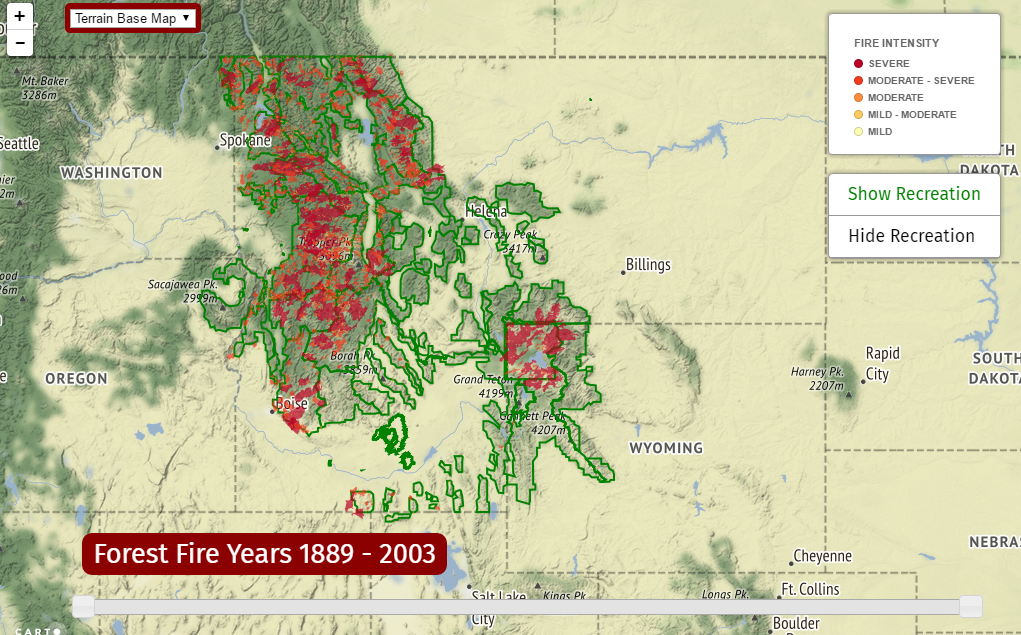
Northwest United States History of Forest Fires
This map shows the history of forest fires in the northwest region of the United States from 1889 to 2003. Also shown are all the national parks and forests within this region along with other useful information relating to this environment.
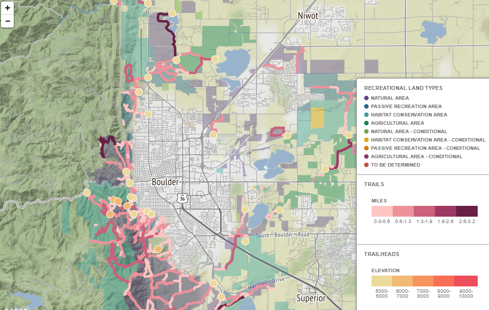
Boulder, Colorado Trails
This map shows all the trails and recreational land types for the city of Boulder, Colorado. The trails are categorized by length and the trail heads are shown by elevation. This map is handy for finding the best trails to hike on in and around Boulder.
Programming for Web Mapping (Map 672) Projects:

Clean Energy Sources
The map here was created using javascript html code on a program known as Brackets. It has the power plants that use renewable energy spread throughout America highlighted on it. The power plant energy sources used within this map are geothermal, solar, wind, and hydro. There are also a lot of links within this map to the images and text relating to the power plants.
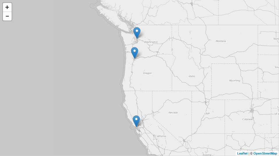
West Coast Cities of the United States
The map here shows several cities on the west coast of the United States. Listed on this map are the cities of San Francisco, Portland, and Seattle. They are all spread across the states of Washington, Oregon, and California. Each popup has unique information about each city and things to do there.
Introduction to New Mapping (Map 671) Projects:
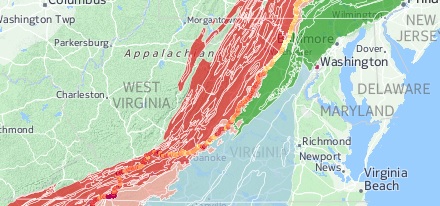
Appalachian Trail
The map shown here was built using QGIS and CartoDB along with Carto CCS. This map is designed to show the elevation profile of the Appalachian Trail and the many types of landscapes it crosses through. Shown here are the geologic regions and ecosystems that exist along the trail.
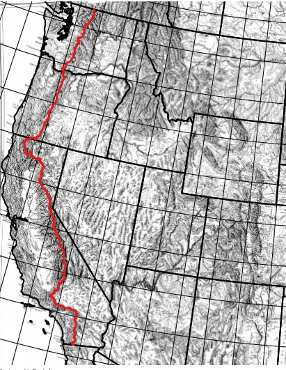
Pacific Crest Trail
This is a topographic map showing the Pacific Crest Trail. It was created using QGIS and then converted into a PDF file. The state lines of the United States were georeferenced along with the trail itself and merged with the topographic map. As one can see, the trail flows alomst perfectly with the topography of the landscape.